


Category: Maps -> South African data -> Cadastral combined
Please note: you need to install PlanetGIS Explorer 7.1 to use the updated maps
Last updated: March 14th, 2020
This is not the date of the source data, but rather when the map was last worked on. See data source below.
Login required: Login
File size: 6.5MB (zip) or 3.5MB (7z)
Source: Chief Surveyor-General, Department of Rural Development and Land Reform
This data is not a legal document. Boundaries are often incorrect or outdated. You must cross reference with survey diagrams and deeds information for important work!
Data obtained from source: February 12th, 2020
Dependencies:
This map requires the following maps, although you can choose to ignore them:
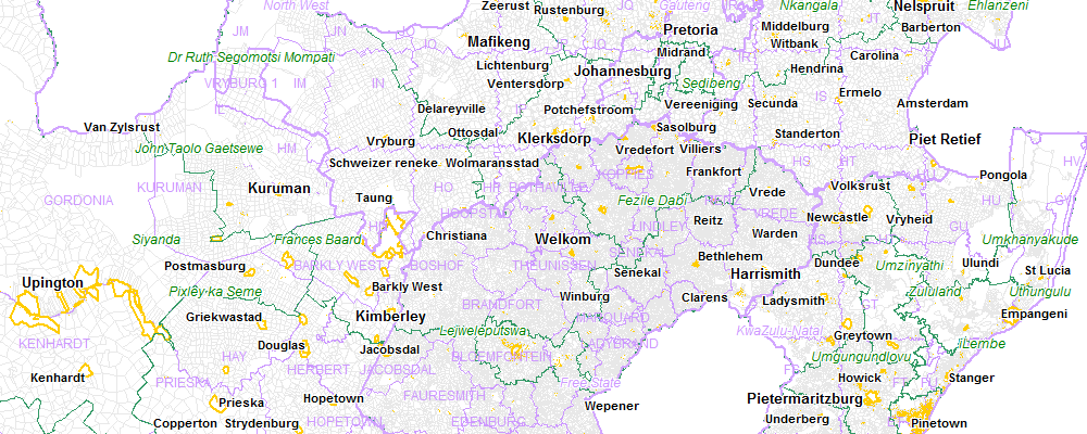
Administrative boundaries
Western Cape cadastral
Eastern Cape cadastral
Free State cadastral
Northern Cape cadastral
KwaZulu-Natal cadastral
Gauteng cadastral
Limpopo cadastral
Mpumalanga cadastral
North West cadastral
Installation instructions:
Unzip all the files into a folder that is not under C:\Program Files. Recent versions of Windows make ZIP archives look like folders, but you must unzip everything into a folder e.g. C:\MyMaps before opening the .db file with PlanetGIS. Right-click on the .zip file and click "Extract All..."
This archive must be extracted into a folder which has all the provinces of South Africa in subfolders (eg. EC, WC, NC, etc). (See example at the bottom).
Download locations:
Johannesburg: ZIP (6.5MB) or 7z (3.5MB)
Dublin: ZIP (6.5MB) or 7z (3.5MB)
BitTorrent: ZIP (6.5MB) or 7z (3.5MB)
You need to install 7-zip to be able to uncompress the smaller version.
A Torrent client like qBittorrent or BitTorrent is required for the torrent download. Please see the FAQ for more information.
Some browsers will warn that the file is "not frequently downloaded". You may need to click "more information" and "download anyway".
Downloads to date: 2218
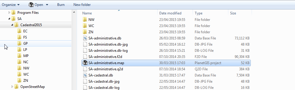
The combined SA-cadastral map and the SA-administrative map needs to be in the same folder and in the parent folder for the provinces, EC, etc. (Some provinces can be omitted)